Dubai’s Roads & Transport Authority (RTA) has officially announced the development of a new Metro Line, a crucial step to alleviate the increasing traffic congestion across the city. With traffic reaching unprecedented levels, the introduction of this new route is undoubtedly a welcome solution.
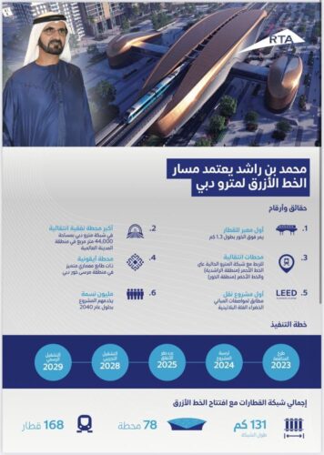
Although it’s in the early stages of development, Sheikh Mohammed confirmed the route during an announcement in November.
The upcoming Metro Line, set to join the existing Red and Green Lines, will span 30 kilometers, with 15.5km of the track running underground and 14.5km above ground. The line is expected to feature a total of 14 stations, with five of them located underground.
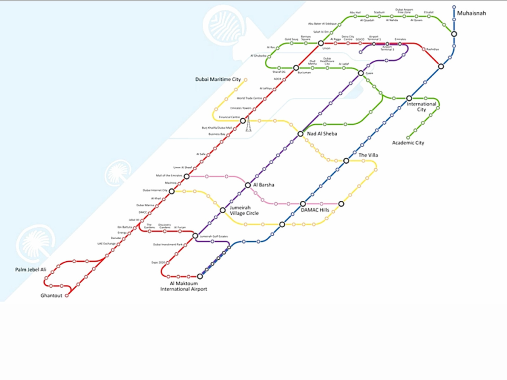
Presently, an online map is making rounds, illustrating the potential locations of the 14 stations for the upcoming Metro Blue Line. The proposed stops include areas such as Muhaisnah, International City, The Villa, and Damac Hills. If these locations are accurate, the Metro Blue Line holds the promise of further connecting Dubai’s suburban areas to the existing vital network.
It’s essential to note that this map is not an official release from Dubai’s Roads & Transport Authority (RTA), and therefore, it doesn’t serve as confirmation for the precise locations of the Blue Line stations or any other details. However, it provides a glimpse into what the future expansion of Dubai’s widely-used network might entail.